All NewsEducationTV
Equities & FundsCrypto & Digital AssetsAI & TechnologyBusiness & CorporateUS Politics & PolicyGeopolitics & Global RiskMacro, Rates & FXCommodities & EnergyEuropean Politics & MarketsAsia-PacificReal Estate & Property
All NewsHome
← Back to US Politics & Policy

US satellite imagery restrictions leave journalists in the dark on Iran and Gaza

Created at 28 Aug · 8:26 AM1 source↑ Market-relevant
IN SHORT

Journalists and analysts are concerned that US government restrictions on commercial satellite imagery are hindering their ability to report on conflicts in Iran and Gaza, resembling censorship. While the stated reason is to prevent adversaries from targeting US troops or infrastructure, experts argue the indefinite freeze lacks justification and may be for accountability avoidance.

Key Numbers

14 daysextended delay for satellite imagery
March 9most recent commercially available images of the Gulf
15 percentPlanet Lab's stock drop over six months
60 countriesnations with functional Earth Observation satellites
156 civilianskilled in bombing of a school in Minab, Iran
120 schoolchildrenamong civilians killed in Minab school bombing
54 percentbuildings destroyed in Dresden during WWII
2023year Reuters journalist Issam Abdallah was killed
24 hourdelay for ESA imagery of parts of the Middle East

Who's Involved

Planet Labs
leading satellite imagery provider implementing restrictions
US government
requested indefinite freeze on satellite imagery
Bill Greer
co-founder of Common Space, concerned about transparency reduction
Tom Brown
investigative reporter, skeptical of censorship claims
Jake Godin
senior researcher at Bellingcat, notes difficulty in verifying damage
Babak Taghvaee
defence and Osint journalist using Chinese satellite imagery
Alex Shaw
Open-Source Intelligence analyst warning of 'warzones going dark'
Kaja Kallas
EU foreign policy chief, recipient of US request for ESA delay
US satellite imagery restrictions leave journalists in the dark on Iran and Gaza

↳ Why This Matters

The restrictions on commercial satellite imagery limit independent verification of events in conflict zones, potentially enabling misinformation and hindering accountability for actions taken by governments and militaries.

Key facts

  • US firm Planet Labs extended restrictions on commercial satellite imagery of the Middle East, citing national security concerns.
  • The indefinite freeze on high-quality imagery was imposed following a US government request.
  • Journalists and analysts argue these restrictions hinder their ability to report on conflicts and resemble censorship.
  • Alternative sources like Chinese and European satellite imagery are being utilized, though they can be more expensive or also subject to delays.
  • The US government's stated justification is to prevent adversaries from using imagery to target US troops or allied infrastructure.

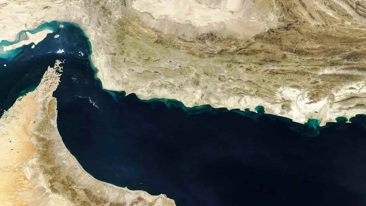
US government restrictions on commercial satellite imagery are increasingly limiting journalists' and analysts' access to crucial visual data, particularly concerning conflicts in Iran and Gaza. Initially, US firm Planet Labs announced a four-day delay for Gulf imagery following joint US-Israel strikes on Iran in late February, which was later extended to 14 days and then to an indefinite freeze on high-quality imagery of the region at the request of the US government.

While the stated justification for these restrictions is to prevent adversaries from using the imagery to target US troops or allied infrastructure, experts and open-source investigators express skepticism. They argue that a two-week delay might address hypothetical risks, but an indefinite freeze lacks comparable justification. Some, like investigative reporter Tom Brown, suggest the restrictions are more about avoiding embarrassment or accountability than deterring adversaries, especially since nations like Iran operate their own satellite networks and utilize imagery from other countries like China.

This reduction in transparency is creating challenges for news outlets and NGOs attempting to assess and verify damage, potentially fostering the spread of misinformation. Bill Greer, co-founder of Common Space, noted that satellite imagery is becoming more politicized, with selectively released images potentially not showing the entire story. The US government can exert influence through direct regulatory means and as a major customer of companies like Planet Labs.

To circumvent these restrictions, journalists and analysts are increasingly turning to European and Chinese satellite providers. However, these alternatives can be more expensive, and even European Space Agency (ESA) imagery has faced delays due to US pressure, with a 24-hour delay imposed on certain Middle Eastern regions following a request from US officials to EU foreign policy chief Kaja Kallas.

Frequently asked questions

The stated justification is to prevent adversaries from using the imagery to target US troops or allied infrastructure in the Gulf. However, experts suggest it may also be to avoid embarrassment or accountability.

Initially a four-day delay, it was extended to 14 days and then became an indefinite freeze on high-quality imagery of the Middle East, though some restrictions have since been lifted.

Journalists and analysts face difficulties in verifying damage and reporting on conflicts, potentially leading to a reduction in transparency and fertile ground for misinformation.

Journalists are increasingly using commercially available satellite imagery from China and Europe, though these can be more expensive and may also face delays.

What Happens Next

01Planet Labs may further adjust its satellite imagery release policies.
02Journalists and analysts will continue to seek alternative sources for satellite imagery.
03The US government may continue to influence commercial satellite imagery release policies.

How It Developed

US firm Planet Labs announced a four-day delay for Gulf imagery following joint US-Israel strikes on Iran and Iranian retaliation.
The delay was extended to 14 days and expanded to most of the Middle East.
Planet Labs imposed an indefinite freeze on high-quality imagery of the region following a US government request.
The most recent commercially available images of the Gulf dated from March 9.
Planet Labs lifted some restrictions, particularly over Iran, on July 1, but most of the suspension over the Gulf remained.
Journalists and analysts are increasingly turning to European and Chinese providers for satellite imagery.

Sources

T1
US satellite imagery restrictions leave journalists in the dark on Iran and GazaMiddle East Eye

Related Stories

Trump's Iran War Drains Navy Budget, Officials Say
27 Aug · 5:11 PM
UN rights office condemns Trump administration's designation of Palestine Action as terrorist group
27 Aug · 10:00 PM
US visa interviews suspended; China imposes sanctions over Iran
28 Aug · 4:50 AM
Trump uses AI images to bolster legacy amid criticism
27 Aug · 10:06 AM
Girl Scouts USA clarifies stance on faith-based badges amid online controversy
27 Aug · 6:41 PM