All NewsEducationTV
Equities & FundsCrypto & Digital AssetsAI & TechnologyBusiness & CorporateUS Politics & PolicyGeopolitics & Global RiskMacro, Rates & FXCommodities & EnergyEuropean Politics & MarketsAsia-PacificReal Estate & Property
All NewsHome
← Back to Geopolitics & Global Risk

China's satellites capture Nepal flood site images

Created at 28 Aug · 12:06 PM2 sources↑ Market-relevant2 events
IN SHORT

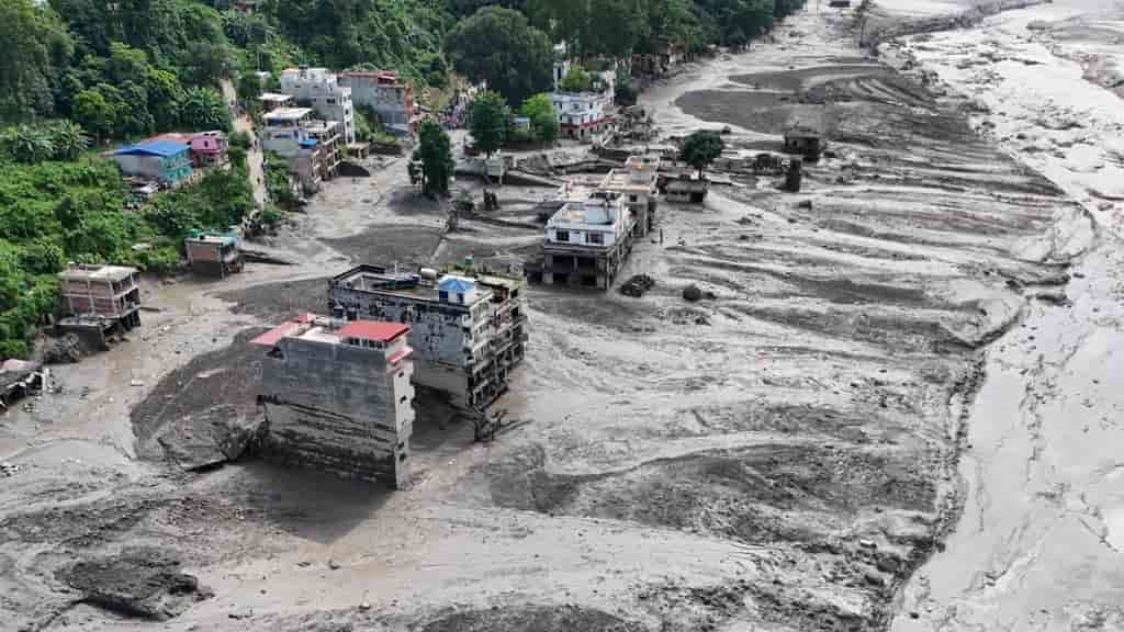
China's radar satellites have captured detailed images of the glacier collapse site in Nepal that triggered a flash flood. This development comes amid a wave of misinformation falsely blaming China for the disaster.

Who's Involved

China
captured satellite images of Nepal flood site amid misinformation
China's satellites capture Nepal flood site images

↳ Why This Matters

The deployment of satellite imagery provides crucial data for understanding the scale and cause of the Nepal flood, while the spread of misinformation highlights geopolitical tensions and the challenges of combating disinformation during natural disasters.

Key facts

  • China's radar satellites have captured detailed images of the glacier collapse site in Nepal.
  • The glacier collapse triggered a flash flood in Nepal.
  • A wave of misinformation falsely blamed China for the disaster.

China's radar satellites have captured detailed images of the glacier collapse site in Nepal that triggered a flash flood. This development comes amid a wave of misinformation falsely blaming China for the disaster.

The South China Morning Post reported that the flood in Nepal led to a surge of online misinformation, with false accusations directed at China regarding the cause of the disaster.

Frequently asked questions

The flood was triggered by a glacier collapse in Nepal.

China's radar satellites captured images of the collapse site. However, misinformation falsely blamed China for the disaster.

The images provide detailed information about the glacier collapse site, aiding in the understanding of the event.

What Happens Next

01Further analysis of satellite data may reveal more about the glacier collapse.
02Efforts to counter misinformation regarding the flood may continue.

How It Developed

A Nepal flash flood triggered a wave of anti-China misinformation online, falsely blaming China for the disaster.
China's radar satellites captured sharp images of the glacier collapse site in Nepal.

Sources

T1
How the Nepal flash flood unleashed a wave of anti-China misinformationSouth China Morning Post
T1
China’s radar satellites capture sharp images of glacier collapse site in NepalSouth China Morning Post

Related Stories

Nepal flood death toll nears 500 as new lake threatens further disaster
27 Aug · 4:30 PM
Nepal, Tibet Floods Leave Hundreds Missing, Death Toll Over 460
27 Aug · 7:10 PM
Deadly Flood Hits Nepal and Tibet After Glacier Collapse
28 Aug · 2:06 AM
Climate crisis destabilising mountain regions, experts warn
27 Aug · 6:11 PM
China pledges emergency aid to Nepal after deadly landslide
28 Aug · 8:35 AM